Part of the
Printed, Griffith's [Tenement] Valuation for the Townland of
Rathbrady Beg, Limavady, 1850
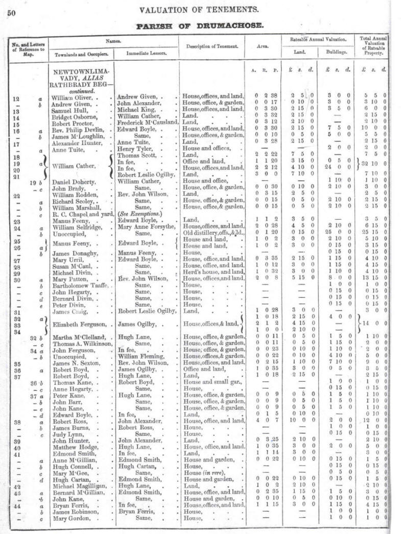
| Here are
two pages [50 and 51] from the printed Griffith's [Tenement] Valuation
of 1858 for part of the townland of Rathbrady Beg which contains
properties which were to become Roe Mill Road Street by 1900.
If you use the blue numbers on the circa 1900 map [which will
open when you click on the link in the Valn. Maps c.1860 column
in the table] you should be able to identify the properties on
both the map and the valuation page that were on the Roe Mill
Road at that time. Note that some numbers between 20 and 37 and
number 50 are relevant. Many of the plots of land between 20 and
37 run from Roe Mill Road to the Dungiven Road [modern-day Ballyquin
Road] so you will have to identify those that are relevant to
Roemill Road and ignore those located on the Ballyquin Road. |
|