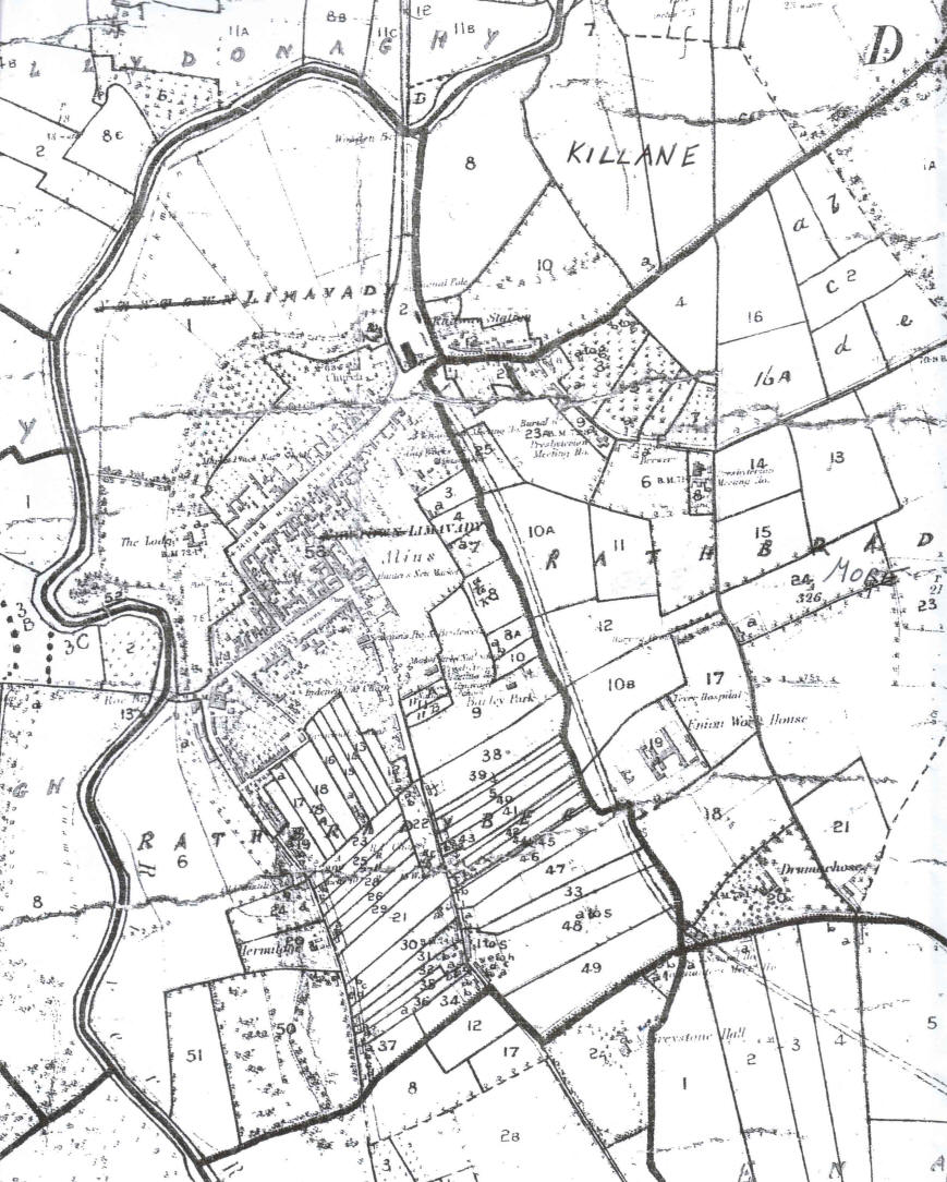
1858 [6 inch] Valuation Map
of Townlands of Rathbrady Beg,
Rathbrady More and Killane.
| The town of Limavady [or
Newtownlimavady as it was known then] is situated
within the townlands of Rathbrady Beg, Rathbrady More
and Killane. This 1858 Valuation Map shows these
townlands with the town, in 1858, mainly located in the
townland of Rathbrady Beg. The workhouse and most
of Ballyclose were located within the townland of
Rathbrady More. The new railway station was in the
townland of Killane. The numbers on the map refer
to plots of land within each townland and correspond to
the numbers in the Printed Valuation. The streets within the town
are shown on a separate, large scale, map of the town.
Note that much of what is the southern part of the town
today did not exist at this time. This included land not
only properties within the townland of Rathbrady Beg but
also within Coolessan. This area was laid out
in plots of land with houses dotted throughout them.
Many of these plots of land were held by residents of
the town with the house on them sublet to tenants. |
Copyright 2010 W. Macafee. |