1859
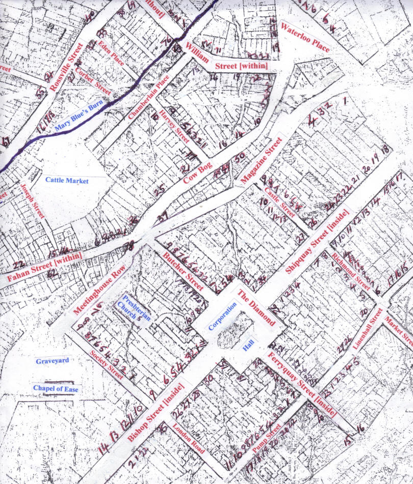
Valuation Map of Streets in the centre of the City of
Londonderry This map has been created from the original 1859 valuation map which is only readable with a magnifying glass and, even then, with difficulty. Using the original base map I have named the streets in red and numbered some of the properties on the map. This should allow you to get some idea of where properties listed in the pages of the printed Griffith's [Tenement] Valuation for this part of the city might be generally located within some of the streets. If you want to be sure of the precise location of a particular building you will need to look at later large-scale maps of the city. The locality study dealing with William Street will show you the valuation maps that you would need to consult in order to do this.
Copyright 2010 W. Macafee. |